
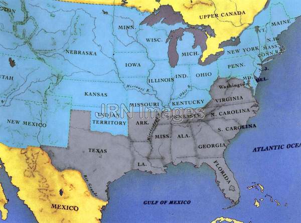    
Title: United States, April 1861 Description: The map of the U.S., showing Confederate and Union States and Territories, following the bombardment of Fort Sumter; Date: April 1861 Category: American Civil War Topic: Artwork Keywords: American Civil War, Confederate states, Confederate territories, Fort Sumter, South Carolina, 1861, maps, Union states, Union territories Orientation: Landscape Dimensions: 2250 x 1674 (3.77 MPixels) (1.34) Print Size: 19.0 x 14.2 cm; 7.5 x 5.6 inches File Size: 10.94 MB (11,472,594 Bytes) Resolution: 300 x 300 dpi Color Depth: 16.7 million (24 BitsPerPixel) Compression: None Image Number: 0000006953c Source: Jay Robert Nash Collection |