
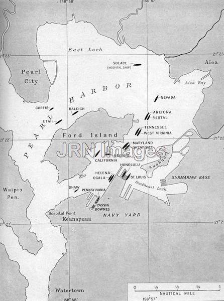    
Title: Map showing warship positions, December, 1941 Description: A map shows the positions of the warships of the Pacific U.S. fleet stationed at Pearl Harbor on the morning of the Japanese sneak attack; Date: December 7, 1941 Category: World War II Keywords: air attacks, bombings, Japan, maps, military installations, military sites, Second World War, U.S. warships, World War II, WWII Orientation: Portrait Dimensions: 1740 x 2340 (4.07 MPixels) (1.34) Print Size: 14.7 x 19.8 cm; 5.8 x 7.8 inches File Size: 11.67 MB (12,233,746 Bytes) Resolution: 300 x 300 dpi Color Depth: 16.7 million (24 BitsPerPixel) Compression: None Image Number: 0000010073 Source: Jay Robert Nash Collection |